Feeds:
Posts
Comments

Posts Tagged ‘British Railways’

South Wales, BR (WR) poster, c 1950s.

South Wales (Welsh: De Cymru) is the region of Wales bordered by England and the Bristol Channel to the east and south, and Mid Wales and West Wales to the north and west. The most densely populated region in the southwest of the United Kingdom, it is home to around 2.2 million people. The region contains almost three-quarters of the population of Wales, including the capital city of Cardiff (population approximately 350,000), as well as Swansea and Newport, with populations approximately 240,000 and 150,000 respectively. The Brecon Beacons national park covers about a third of South Wales, containing Pen y Fan, the highest mountain south of Snowdonia.

a1097_south wales_002

The region is loosely defined, but it is generally considered to include the historic counties of Glamorgan and Monmouthshire, sometimes extending westwards to include Carmarthenshire and Pembrokeshire. In the western extent, from Swansea westwards, local people would probably recognise that they lived in both South Wales and in West Wales — there is considerable overlap in these somewhat artificial boundaries. Areas to the north of the Brecon Beacons and Black Mountains are generally considered part of Mid Wales.

a1097_south wales_003

History

The South Wales Valleys and upland mountain ridges were once a very rural area of great natural beauty, noted for its river valleys and ancient forests and lauded by romantic poets such as William Wordsworth as well as poets in the Welsh language, although the interests of the latter lay more in society and culture than in the evocation of natural scenery. This natural beauty changed to a considerable extent during the early Industrial Revolution when the Glamorgan and Monmouthshirevalley areas were exploited for coal and iron. By the 1830s, hundreds of tons of coal were being transported by barge to ports in Cardiff and Newport. In the 1870s, coal was transported by railway networks to Newport Docks, at the time the largest coal exporting docks in the world, and by the 1880s coal was being exported fromBarry in the Vale of Glamorgan.

a1097_south wales_001

The Marquess of Bute, who owned much of the land north of Cardiff, built a steam railway system on his land that stretched from Cardiff into many of the South Wales Valleys where the coal was being found. Lord Bute then charged taxes per ton of coal that was transported out using his railways. With coal mining and iron smelting being the main trades of South Wales, many thousands of immigrants from the English Midlands, Scotland, Ireland, Cornwall and even Italy came and set up homes and put down roots in the region. Very many came from other coal mining areas such as Somerset, the Forest of Dean in Gloucestershire and the tin mines of Cornwall such as Geevor Tin Mine, as a large but experienced and willing workforce was required. Whilst some of the migrants left, many settled and established in the South Wales valleysbetween Swansea and Abergavenny, English speaking communities with a unique identity. Industrial workers were housed in cottages and terraced houses close to the mines and foundries in which they worked. The large influx over the years caused overcrowding which led to outbreaks of Cholera, and on the social and cultural side, the near-loss of the Welsh language in the area.

a1097_south wales_005

The 1930s inter-war Great Depression in the United Kingdom saw the loss of almost half of the coal pits in the South Wales coalfield and this number declined further in the years following World War II. This number is now very low, following the UK miners’ strike (1984–1985), and the last ‘traditional’ deep-shaft mine, Tower Colliery, closed in January 2008.

a1097_south wales_006

Despite the intense industrialisation of the coal mining valleys, many parts of the landscape of South Wales such as the upper Neath valley, theVale of Glamorgan and the valleys of the River Usk and River Wye remain distinctly beautiful and unspoilt and have been designated SSSI, Sites of Special Scientific Interest. In addition to this, many once heavily industrialised sites have reverted to wilderness, some provided with a series of cycle tracks and other outdoor amenities. Large areas of forestry and open moorland also contribute to the amenity of the landscape.

Text from Wikipedia

Read Full Post »

somerset

Somerset (Listeni/ˈsʌmərsɛt/ or /ˈsʌmərsɨt/) is a county in South West England which borders Gloucestershire to the north,Wiltshire to the east, Dorset to the south-east and Devon to the south-west. It is bounded to the north and west by the Bristol Channel and the estuary of the River Severn, its coastline facing a1090_somerset_01south eastern Wales. Its traditional northern border is the River Avon.[1] Somerset’s county town is Taunton.

Somerset is a rural county of rolling hills such as the Blackdown Hills, Mendip Hills, Quantock Hills and Exmoor National Park, and large flat expanses of land including the Somerset Levels. There is evidence of human occupation from Palaeolithic times, and of subsequent settlement in the Roman and Anglo-Saxon periods. The county played a significant part in the consolidation of power and rise of King Alfred the Great, and later in the English Civil War and the Monmouth Rebellion.

Agriculture is a major business in the county. Farming of sheep and cattle, including for wool and the county’s famous cheeses (most notably Cheddar), are traditional and contemporary, as is the more unusual cultivation of willow a1090_somerset_02for basket weaving. Apple orchards were once plentiful, and Somerset is still known for the production of strong cider. Unemployment is lower than the national average; the largest employment sectors are retail, manufacturing, tourism, and health and social care. Population growth in the county is higher than the national average.
History

Main article: History of Somerset

The caves of the Mendip Hills were settled during the Palaeolithic period, and contain extensive archaeological sites such as those at Cheddar Gorge. Bones from Gough’s Cave have been dated to 12,000 BC, and a complete skeleton, a1090_somerset_03known as Cheddar Man, dates from 7150 BC. Examples of cave art have been found in caves such as Aveline’s Hole. Some caves continued to be occupied until modern times, including Wookey Hole.

The Somerset Levels—specifically the dry points such as Glastonbury and Brent Knoll— also have a long history of settlement, and are known to have been settled by Mesolithic hunters. Travel in the area was helped by the construction of one of the world’s oldest known engineered roadways, the Sweet Track, which dates from 3807 BC or 3806 BC.

The exact age of the henge monument at Stanton Drew stone circles is unknown, but it is believed to be Neolithic. There are numerous Iron Age hill forts, some of which, like Cadbury Castle and Ham Hill, were later reoccupied in the Early Middle Ages.

a1090_somerset_04On the authority of the future emperor Vespasian, as part of the ongoing expansion of the Roman presence in Britain, the Second Legion Augusta invaded Somerset from the south-east in AD 47. The county remained part of the Roman Empire until around AD 409, when the Roman occupation of Britain came to an end. A variety of Roman remains have been found, including Pagans Hill Roman Temple in Chew Stoke, Low Ham Roman Villa and the Roman Baths that gave their name to the city of Bath.

After the Romans left, Britain was invaded by Anglo-Saxon peoples. By AD 600 they had established control over much of what is now England, but Somerset was still in native British hands. The British held back Saxon advance into the a1090_somerset_05south-west for some time longer, but by the early eighth century King Ine of Wessex had pushed the boundaries of the West Saxon kingdom far enough west to include Somerset. The Saxon royal palace in Cheddar was used several times in the 10th century to host the Witenagemot. After the Norman Conquest, the county was divided into 700 fiefs, and large areas were owned by the crown, with fortifications such as Dunster Castle used for control and defence. Somerset contains HMP Shepton Mallet, England’s oldest prison still in use, which opened in 1610. In the English Civil War Somerset was largely Parliamentarian, with key engagements being the Siege of Taunton and the Battle of Langport. In 1685 the Monmouth Rebellion was played out in Somerset and neighbouring Dorset. The rebels landed at Lyme Regis and travelled north, hoping to capture Bristol and Bath, but they were a1090_somerset_06defeated in the Battle of Sedgemoor at Westonzoyland, the last pitched battle fought in England. Arthur Wellesley took his title, Duke of Wellington from the town of Wellington; he is commemorated on a nearby hill by a large, spotlit obelisk, known as the Wellington Monument.

The Industrial Revolution in the Midlands and Northern England spelled the end for most of Somerset’s cottage industries. Farming continued to flourish, however, and the Bath and West of England Society for the Encouragement of Agriculture, Arts, Manufactures and Commerce was founded in 1777 to improve farming methods. Despite this, 20 years later John Billingsley conducted a survey of the county’s agriculture in 1795 and found that agricultural methods could still be improved. Coal mining was an important industry in north Somerset during the 18th and 19th centuries, and by 1800 it was prominent in Radstock. The Somerset Coalfield reached its peak production a1090_somerset_07by the 1920s, but all the pits have now been closed, the last in 1973. Most of the surface buildings have been removed, and apart from a winding wheel outside Radstock Museum, little evidence of their former existence remains. Further west, the Brendon Hills were mined for iron ore in the late 19th century; this was taken by rail to Watchet Harbour for shipment to the furnaces at Ebbw Vale.

Many Somerset soldiers died during the First World War, with the Somerset Light Infantry suffering nearly 5,000 casualties. War memorials were put up in most of the county’s towns and villages; only nine, described as the Thankful Villages, had none of their residents killed. During the Second World War the county was a base for troops preparing for the D-Day landings. Some of the hospitals which were built for the casualties of the war remain in use. The Taunton Stop Line was set up to repel a potential German invasion. The a1090_somerset_08remains of its pill boxes can still be seen along the coast, and south through Ilminster and Chard.

A number of decoy towns were constructed in Somerset in World War II to protect Bristol and other towns, at night. They were designed to mimic the geometry of “blacked out” streets, railway lines, and Bristol Temple Meads railway station, to encourage bombers away from these targets. One, on the radio beam flight path to Bristol, was constructed on Beacon Batch. It was laid out by Shepperton Film Studios, based on aerial photographs of the city’s railway marshalling yards. The decoys were fitted with dim red lights, simulating activities like the stoking of steam locomotives. Burning bales of straw soaked in creosote were used to simulate the effects of incendiary bombs dropped by the first wave of Pathfinder night a1090_somerset_09bombers; meanwhile, incendiary bombs dropped on the correct location were quickly smothered, wherever possible. Drums of oil were also ignited to simulate the effect of a blazing city or town, with the aim of fooling subsequent waves of bombers into dropping their bombs on the wrong location. The Chew Magna decoy town was hit by half-a-dozen bombs on 2 December 1940, and over a thousand incendiaries on 3 January 1941. The following night the Uphill decoy town, protecting Weston-super-Mare‘s airfield, was bombed; a herd of dairy cows was hit, killing some and severely injuring others.

Transport

Main article: Transport in Somerset

Somerset has 6,531 km (4,058 mi) of roads. The main arterial routes, which include the M5 motorway, A303, A37, A38 and A39, give good access across the a1090_somerset_10county, but many areas can only be accessed via narrow lanes. Rail services are provided by the West of England Main Line through Yeovil, the Bristol to Taunton Line,Heart of Wessex Line which runs from Bristol to Weymouth and the Reading to Taunton line. Bristol Airport provides national and international air services.

The Somerset Coal Canal was built in the early 19th century to reduce the cost of transportation of coal and other heavy produce. The first 16 kilometres (10 mi), running from a junction with the Kennet and Avon Canal, along the Cam valley, to a terminal basin at Paulton, were in use by 1805, together with several tramways. A planned 11.7 km (7.3 mi) branch to Midford was never built, but in 1815 a tramway was laid along its towing path. In 1871 the tramway was purchased by the Somerset and Dorset Joint Railway (S&DJ Rand operated until the 1950s.

a1090_somerset_11The 19th century saw improvements to Somerset’s roads with the introduction of turnpikes, and the building of canals and railways. Nineteenth-century canals included the Bridgwater and Taunton Canal, Westport Canal, Glastonbury Canal and Chard Canal. The Dorset and Somerset Canal was proposed, but little of it was ever constructed and it was abandoned in 1803.

The usefulness of the canals was short-lived, though some have now been restored for recreation. The 19th century also saw the construction of railways to and through Somerset. The county was served by five pre-1923 Grouping railway companies: the Great Western Railway (GWR); a branch of the Midland Railway (MR) to Bath Green Park (and another one to Bristol); the Somerset and a1090_somerset_12Dorset Joint Railway, and the London and South Western Railway (L&SWR). The former main lines of the GWR are still in use today, although many of its branch lines were scrapped. The former lines of the Somerset and Dorset Joint Railway closed completely, as has the branch of the Midland Railway to Bath Green Park (and to Bristol St Philips); however, the L&SWR survived as a part of the present West of England Main Line. None of these lines, in Somerset, are electrified. Two branch lines, the West and East Somerset Railways, were rescued and transferred back to private ownership as “heritage” lines. The fifth railway was a short-lived light railway, the Weston, Clevedon and Portishead Railway. The West Somerset Mineral Railway carried the iron ore from the Brendon Hills to Watchet.

a1090_somerset_13Until the 1960s the piers at Weston-super-Mare, Clevedon, Portishead and Minehead were served by the paddle steamers of P and A Campbell who ran regular services to Barry and Cardiff as well as Ilfracombe and Lundy Island. The pier at Burnham-on-Sea was used for commercial goods, one of the reasons for the Somerset and Dorset Railway was to provide a link between the Bristol Channel and the English Channel. The pier at Burnham-on-Sea is the shortest pier in the UK. In the 1970s the Royal Portbury Dock was constructed to provide extra capacity for the Port of Bristol.

For long-distance holiday traffic travelling through the county to and from Devon and Cornwall, Somerset is often regarded as a marker on the journey. North–south traffic moves through the county via the M5 Motorway. Traffic to and from the east travels either via the A303 road, or the M4 Motorway, which runs east–west, crossing the M5 just beyond the northern limits of the county.

Text from Wikipedia

Read Full Post »

snowdon
Snowdon (Welsh: Yr Wyddfa, pronounced [əɾ ˈwɨ̞ðva]) is the highest mountain in Wales, at an elevation of 1,085 metres (3,560 ft) above sea level, and the highest point in the British Isles outside the Scottish Highlands. It is located inSnowdonia National Park (Parc Cenedlaethol Eryri) in Gwynedd, and has been described as “probably the busiest mountain in Britain”. It is designated as a national nature reserve for its rare flora and fauna.

a1085_snowdon_02
Richard Wilson – View of Snowdon from Llyn Nantlle

The rocks that form Snowdon were produced by volcanoes in the Ordovician period, and the massif has been extensively sculpted by glaciation, forming the pyramidal peak of Snowdon and the arêtes of Crib Goch and Y Lliwedd. The cliff faces on Snowdon, including Clogwyn Du’r Arddu, are significant for rock climbing, and the mountain was used by Edmund Hillary in training for the 1953 ascent of Mount Everest.

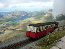
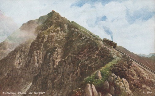
Snowdon offers some of the best views in Britain. The summit can be reached by a number of well-known paths, and by the Snowdon Mountain Railway, a rack and pinion railway opened in 1896 which carries passengers the 4.7 miles (7.6 km) from Llanberis to the summit station. The summit also houses a cafe called Hafod Eryri, open only when the railway is operating and built in 2006 to replace one built in the 1930s. The railway generally operates to the summit station from Whitsun to October. The daily running schedule depends on weather and customer demand.

a1085_snowdon_03

The name Snowdon is from the Old English for “snow hill”, while the Welsh name – Yr Wyddfa – means “thetumulus“, which may refer to the cairn thrown over the legendary giant Rhitta Gawr after his defeat by King Arthur. As well as other figures from Arthurian legend, the mountain is linked to a legendary afanc (water monster) and the Tylwyth Teg (fairies).

Ascents

The first recorded ascent of Snowdon was by the botanist Thomas Johnson in 1639. However, the 18th-century Welsh historian Thomas Pennant mentions a “triumphal fair upon this our chief of mountains” following Edward I‘s conquest of Wales in 1284, which could indicate the possibility of earlier ascents.

Snowdon offers some of the most extensive views in the British Isles. On exceptionally clear days, Ireland, Scotland, England, and the Isle of Man are all visible, as well as 24 counties, 29 lakes and 17 islands. The view between Snowdon and Merrick (southern Scotland) is the longest theoretical line of sight in the British Isles at 144 miles (232 km).

Snowdon has been described as “probably the busiest mountain in Britain”; a number of well-established and engineered footpaths lead to Snowdon’s summit from all sides, and can be combined in various ways. The circular walk starting and ending at Pen-y-Pass and using the Crib Goch route and the route over Y Lliwedd is called the Snowdon Horseshoe, and is considered “one of the finest ridge walks in Britain”. The routes are arranged here anticlockwise, starting with the path leading from Llanberis. In winter conditions, all these routes become significantly more dangerous and crampons and ice axes should be carried. Many inexperienced walkers have been killed over the years attempting to climb the mountain via the main paths.

Snowdon Mountain Railway

Main article: Snowdon Mountain Railway

a1085_snowdon_05

a1085_snowdon_01The Snowdon Mountain Railway (SMR) (Welsh: Rheilffordd yr Wyddfa) is a narrow gauge rack and pinion mountain railway that travels for 4.75 miles (7.6 km) from Llanberis to the summit of Snowdon. It is the only public rack and pinion railway in the United Kingdom, and after more than 100 years of operation it remains a popular tourist attraction. Single carriage trains are pushed up the mountain by either steam locomotives or diesel locomotives. It has also previously used diesel railcars as multiple units. The railway was constructed between December 1894, when the first sod was cut by Enid Assheton-Smith (after whom locomotive No.2 was named), and February 1896, at a total cost of £63,800 (£6,442,000 as of 2014).

a1085_snowdon_06a1085_snowdon_04

Text from Wikipedia

Read Full Post »

shrewsbury
Shrewsbury (Listeni/ˈʃrzbri/ or Listeni/ˈʃrzbri/) is the county town of Shropshire, in the West Midlands of England, on theRiver Severn. It has a population of approximately 72,000 and is the second largest town in Shropshire, after Telford.

a1076_shrewsbury_02Shrewsbury is a historic market town whose town centre has a largely unaltered medieval street plan and over 660listed buildings, including several examples of timber framing from the 15th and 16th centuries. Shrewsbury Castle, a red sandstone fortification, and Shrewsbury Abbey, a former Benedictine monastery, were founded in 1074 and 1083 respectively by the Norman Earl of Shrewsbury, Roger de Montgomery.

The Shrewsbury Flower Show is one of the largest horticultural events in the country of England.

Today, 9 miles (14 km) east of the Welsh border, Shrewsbury serves as the commercial centre for Shropshire and mid-Wales, with a retail output of over £299 million per year. There are some light industry and distribution centres, such as Battlefield Enterprise Park, mainly on the outskirts. The A5 and A49 trunk roads cross near to the town, as do five railway lines at Shrewsbury railway station.

Early history

a1076_shrewsbury_03The town was possibly the site of the capital of Powys, known to the ancient Britons as Pengwern, signifying "the alder hill";[ and in Old English as Scrobbesburh (dative Scrobbesbyrig), which has several meanings; "fort in the scrub-land region", "Scrobb’s fort", "shrubstown" or "the town of the bushes". This name gradually evolved in three directions, into Sciropscire, which became Shropshire; into Sloppesberie, which became Salop/Salopia (an alternative name for both town and county), and into Schrosberie, which eventually became the town’s name, Shrewsbury. Its Welsh name Amwythigmeans "fortified place".

a1076_shrewsbury_04It is believed that Anglo-Saxon Shrewsbury was most probably a settlement fortified through the use of earthworks comprising a ditch and rampart, which were then shored up with a wooden stockade.

Nearby is the village of Wroxeter, 5 miles (8 km) to the south-east, site of the now ruined Roman city of Viroconium Cornoviorum. Viroconium was the fourth largest civitas capital in Roman Britain. As Caer Guricon it may have served as the early Dark Age capital of the kingdom of Powys. The Shrewsbury area’s regional importance in the Roman era was recently underlined with the discovery of the Shrewsbury Hoard in 2009.

a1076_shrewsbury_05Over the ages, the geographically important town has been the site of many conflicts, particularly between the English and Welsh. Shrewsbury was the seat of the Princes of Powis for many years; however, the Angles, under King Offa of Mercia, took possession of it in 778.

There is evidence to show that by the beginning of the 900’s, Shrewsbury was home to a mint.

Medieval

The Welsh again besieged it in 1069, but were repelled by William the Conqueror. Roger de Montgomery was given the town as a gift from William, and built Shrewsbury Castle in 1074, taking the title of Earl. The 3rd Earl, Robert of Bellême was deposed in 1102, in consequence of taking part in the rebellion against Henry I.

a1076_shrewsbury_06In 1138, King Stephen successfully besieged the castle held by William FitzAlan for the Empress Maud during the period known as The Anarchy.

It was in the late Middle Ages (14th and 15th centuries) when the town was at its height of commercial importance. This was mainly due to the wool trade, a major industry at the time, with the rest of Britain and Europe, especially with the River Severn and Watling Street as trading routes.

In 1403 the Battle of Shrewsbury was fought a few miles north of the town centre, at Battlefield; it was fought between King Henry IV and Henry Hotspur Percy, with the King emerging victorious, an event celebrated in William Shakespeare‘s Henry IV, Part 1, Act 5.

a1076_shrewsbury_08Shrewsbury’s monastic gathering was disbanded with the Dissolution of the Monasteries and as such the Abbey was closed in 1540. However, it is believed that Henry VIII thereafter intended to make Shrewsbury a cathedral city after the formation of the Church of England, but the citizens of the town declined the offer. Despite this, Shrewsbury throve throughout the 16th and 17th centuries; largely due to the town’s fortuitous location, which allowed it to control the Welsh wool trade. As a resultant a number of grand edifices, including the 1575 Ireland’s Mansion and 1658 Draper’s Hall, were constructed. It was also in this period thatEdward VI gave permission for the foundation of a free school, which was later to become Shrewsbury School.

Early Modern

a1076_shrewsbury_09During the English Civil War, the town was a Royalist stronghold and only fell to Parliament forces after they were let in by a parliamentarian sympathiser at the St Mary’s Water Gate (now also known as Traitor’s Gate). Shrewsbury Unitarian Church was founded in 1662. By the 18th century Shrewsbury had become an important market town and stop off for stagecoaches travelling between London and Holyhead on their way to Ireland; this led to the establishment of a number of coaching inns, many of which, such as the Lion Hotel, are extant to this day.

Local soldier and statesman Robert Clive was Shrewsbury’s MP from 1762 until his death in 1774. Clive also served once as the town’s mayor in 1762.

a1076_shrewsbury_10St Chad’s Church collapsed in 1788 after attempts to expand the crypt compromised the structural integrity of the tower above; it was, however, rebuilt just four years later as a large neo-classical round church in a new location close to the Quarry Park.

In the period directly after Napoleon‘s surrender after Waterloo, the town’s own 53rd (Shropshire) Regiment of Foot was sent to guard him in his exile on St Helena. A locket containing a lock of the emperor’s hair (presented to an officer of the 53rd) remains, to this day, in the collections of the Shropshire Regimental Museum at Shrewsbury Castle.

Read Full Post »

scotland 2scotland

Scotland (/ˈskɒt.lənd/; Scots: [ˈskɔt.lənd]; Scottish Gaelic: Alba [ˈal̪ˠapə] ( listen)) is a country that is part of the United Kingdom and covers the northern third of the island of Great Britain. It shares a border with England to the south, a1058_scotland_01and is otherwise surrounded by the Atlantic Ocean, with the North Sea to the east and the North Channel and Irish Sea to the south-west. In addition to the mainland, the country is made up of more than 790 islands, including the Northern Isles and the Hebrides.

Edinburgh, the country’s capital and second-largest city, was the hub of the Scottish Enlightenment of the 18th century, which transformed Scotland into one of the commercial, intellectual, and industrial powerhouses of Europe. Glasgow, Scotland’s largest city, was a1058_scotland_03once one of the world’s leading industrial cities and now lies at the centre of the Greater Glasgow conurbation. Scottish waters consist of a large sector of the North Atlantic and the North Sea, containing the largest oil reserves in the European Union. This has given Aberdeen, the third-largest city in Scotland, the title of Europe’s oil capital.

The Kingdom of Scotland emerged as an independent sovereign state in the Early Middle Ages and continued to exist until 1707. By inheritance in 1603, King James VI of Scotland became King of England and King of Ireland, thus forming a1058_scotland_04apersonal union of the three kingdoms. Scotland subsequently entered into a political union with England on 1 May 1707 to create the new Kingdom of Great Britain. The union also created a new Parliament of Great Britain, which succeeded both the Parliament of Scotland and the Parliament of England. The Treaty of Union was agreed in 1706 and enacted by the twin Acts of Union 1707 passed by the Parliaments of both countries, despite some popular opposition and anti-union riots in Edinburgh, Glasgow, and elsewhere. Great Britain itself subsequently entered into a political union with Ireland on 1 January 1801 to create the United Kingdom of Great Britain and Ireland.

a1058_scotland_07Scotland’s legal system has remained separate from those of England and Wales and Northern Ireland, and Scotland constitutes a distinct jurisdiction in public and private law. The continued existence of legal, educational and religious institutions distinct from those in the remainder of the UK have all contributed to the continuation of Scottish culture and national identity since the 1707 union. In 1999, a devolved legislature, the Scottish Parliament, was reconvened with authority over many areas of home affairs following a referendum in 1997. In May 2011, the Scottish National Party won an overall majority in the Scottish Parliament; as a result a referendum on Scottish independence took place on 18 September a1058_scotland_052014, in which independence was rejected by a majority of the Scottish electorate.

Scotland is a member nation of the British–Irish Council, and the British–Irish Parliamentary Assembly. Scotland is represented in the European Union and the European Parliament with six MEPs


Text from Wikipedia

Read Full Post »

scarborough

Scarborough (/ˈskɑrbrə/ or /ˈskɑrbərə/) is a town on the North Sea coast of North Yorkshire, England. Historicallypart of the North Riding of Yorkshire, the town lies between 10–230 feet (3–70 m) above sea level, rising steeply northward and westward from the harbour on to limestone cliffs. The older part of the town lies around the harbour and is protected by a rocky headland.

With a population of around 50,000 Scarborough is the largest holiday resort on the Yorkshire coast. The town has fishing and service industries, including a growing digital and creative economy, as well as being a tourist destination. Inhabitants of the town are known as Scarborians.

Scarborough Beach, Yorkshire. LNER Vintage Travel Poster by Andrew Johnson. 1933

History

Origins

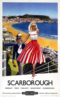
The town was reportedly founded around 966 AD as Skarðaborg by Thorgils Skarthi, a Viking raider, though there is no archaeological evidence to support these claims made during the 1960s, as part of a pageant of Scarborough events. The origin of this belief is a fragment of an Icelandic Saga. In the 4th century there had briefly been a Roman signal station on Scarborough headland ÔScarboroughÕ, BR poster, 1959.and there is evidence of much earlier Stone Age and Bronze Age settlements. However, any new settlement was soon burned to the ground by a rival band of Vikings under Tosti (Tostig Godwinson), Lord of Falsgrave, and Harald III of Norway. The destruction and massacre meant that very little remained to be recorded in the Domesday survey of 1085. The original inland settlement of Falsgrave was also a Saxon village rather than a Viking one.

Feudal and medieval

Scarborough recovered under King Henry II, who built an Angevin stone castle on the headland, and granted the town charters in 1155 and 1163, permitting a market on the sands, and establishing rule by burgesses. Edward II granted Scarborough Castle to his favoured friend, Piers Gaveston. The castle was subsequently besieged by forces led by the barons Percy, Warenne, Clifford and Pembroke. Gaveston was captured and transported to Oxford and then Warwick Castle for execution.

a1050_scarborough_05In the Middle Ages, Scarborough Fair, permitted in a royal charter of 1253, held a six-week trading festival attracting merchants from all over Europe. It ran from Assumption Day, 15 August, until Michaelmas Day, 29 September. The fair continued to be held for 500 years, from the 13th century to the 18th century, and is commemorated in the song Scarborough Fair:

Are you going to Scarborough Fair?
—parsley, sage, rosemary and thyme….
Resort development

Scarborough and its castle changed hands seven times between Royalists and Parliamentarians during the English Civil War of the 1640s, enduring two lengthy and violent sieges. Following the civil war, much of the town lay in ruins.

In 1626, Elizabeth Farrow discovered a stream of acidic water running from one of the cliffs to the south of the town. This gave birth to Scarborough Spa, and Dr Wittie’s book about the spa waters published in 1660 attracted a flood of visitors to the town. Scarborough Spa became Britain‘s first seaside resort, though the first rolling bathing machines were not noted on the sands until 1735.

a1050_scarborough_02

The coming of the Scarborough–York railway in 1845 increased the tide of visitors. Scarborough railway station claims a record for the world’s longest platform seat.

© Tony Bartholomew 07802 400651
mail@bartpics.co.ukGrowing influx of visitors convinced a young architect (John Gibson) with an eye to the future to open Scarborough’s first purpose-built hotel. In 1841 a railway link between York and Scarborough was being talked of and he decided that the area above the popular Spa building could be developed. He designed and laid the foundations of a ‘hotel’. (This was a new name derived from the word ‘hostel’ which would serve the same purpose but would be bigger and finer than the traditional inns). Gibson then passed the construction of this hotel to the newly formed South Cliff Building Company. On Tuesday, 10 June 1845 Scarborough’s first hotel was opened—a marketing coup at the time, as the Grand Hotel, soon to be Europe’s largest, was not yet finished.

Architecture

a1050_scarborough_01
a1050_scarborough_067When the Grand Hotel was completed in 1867 it was one of the largest hotels in the world and one of the first giant purpose-built hotels in Europe. Four towers represent the seasons, 12 floors represent the months, 52 chimneys represent the weeks and originally 365 bedrooms represented the days of the year. A blue plaque outside marks where the novelist Anne Brontë died in 1849. She was buried in the graveyard of St Mary’s Church by the castle.

The town has a fine Anglican church, St. Martin-on-the-Hill, built in 1862–63 as the parish church of South Cliff. It contains works by Dante Gabriel Rossetti, William Morris, Edward Burne-Jones and Ford Madox Brown.

Text from Wikipedia 

Read Full Post »
saltburn

Saltburn-by-the-Sea is a seaside resort in Redcar and Cleveland, a unitary authority in the ceremonial county of North Yorkshire, England. Historically part of the North Riding of Yorkshire, the town is around 12 miles (19 km) east of Middlesbrough, and had a population of 5,912 at the 2001 Census.

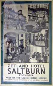
'Saltburn-by-the-Sea', LNER poster, 1923-1947.The development of Middlesbrough and Saltburn was driven by the discovery of iron stone in the Cleveland Hills, the monies of the Pease family of Darlington, and the development of two railways to transport the minerals.

History

Old Saltburn

Old Saltburn is the original settlement, located in the Saltburn Gill. Records are scarce on its origins, but it was a centre for smugglers, and publican John Andrew is referred to as ‘king of smugglers’.

a1046598_saltburn_04In 1856, the hamlet consisted of the Ship Inn and a row of houses, occupied by farmers and fishermen. In the mid-18th century, authors Laurence Sterne and John Hall-Stevenson enjoyed racing chariots on the sands at Saltburn.

Early development

The Pease family developed Middlesbrough as an industrial centre and, after discovery of iron stone, the Stockton & Darlington Railway and the West Hartlepool Harbour and Railway Company developed routes into East Cleveland. By 1861, the S&DR reached Saltburn with the intention of continuing to Brotton, Skinningrove and Loftus but the WHH&RCo had already developed tracks in the area, leaving little point in the extending the S&DR tracks further.

a1046598_saltburn_01In 1858, while walking along the coast path towards Old Saltburn to visit his brother Joseph in Marske, Henry Pease saw a prophetic vision of a town arising on the cliff and the quiet, unfrequented and sheltered glen turned into a lovely garden. The Pease family owned Middlesbrough Estate and had control of the S&DR, and agreed to develop Henry’s vision by forming the Saltburn Improvement Company.

Land was purchased from the Earl of Zetland, and the company commissioned surveyor George Dickinson to lay out what became an interpretation of a gridiron street layout, detracted from by the railway which ran through the site. With as many houses as possible having sea views, the layout was added to by the so-called Jewel streets along the seafront—Coral, Garnet, Ruby, Emerald, Pearl, Diamond and Amber Streets, said to be a legacy of Henry’s vision.

a1046598_saltburn_02After securing the best positions for development by the SIC, money was raised for construction by selling plots to private developers and investors. Most buildings are constructed using ‘Pease’ brick, transported from Darlington by the S&DR, with the name Pease set into the brick. The jewel in Henry Pease’s crown is said to have been The Zetland Hotel with a private platform, one of the world’s earliest railway hotels.

a1046598_saltburn_06The parcel of land known as Clifton Villas was sold by the Saltburn Improvement Company (SIC) in 1865 to William Morley from London who built the property, but a stipulation on the land in the deed of covenant, was that any trees planted along Britannia Terrace (now Marine Parade) were not to exceed 1′ 6" above the footpath to preserve the view of Henry Pease’s vision to form Saltburn. However Pease owned a property on Britannia Terrace. The Redcar to Saltburn Railway opened in 1861 as an extension of the Middlesbrough to Redcar Railway of 1846. The line was extended to Whitby as part of the Whitby Redcar and Middlesbrough Union Railway.

Text from Wikipedia 

Read Full Post »

royal_rothesay
The town of Rothesay Listeni/ˈrɒθ.si/ (Scottish Gaelic: Baile Bhòid) is the principal town on the Isle of Bute, in the council area of Argyll and Bute, Scotland. It can a104657_Rothesay_05be reached by ferry from Wemyss Bay which offers an onward rail link to Glasgow. At the centre of the town is Rothesay Castle, a ruined castle which dates back to the 13th century, and which is unique in Scotland for its circular plan. Rothesay lies along the coast of the Firth of Clyde.

History

Rothesay was the county town in the civil parish of Rothesay in county of Bute, which included the islands of Great Cumbrae, Little Cumbrae and Arran. The county buildings, now partially closed down, overlook the castle.

Vintage travel poster produced for the London Midland & Scottish (LMS) and London & North Eastern Railway (LNER), promoting rail travel to Royal Rothesay, Scotland, showing a cliff-top view of the bay, where pleasure boats are seen departing from a pier. Artwork by Robert Houston.During the Victorian era, Rothesay developed as a popular tourist destination. It became hugely popular with Glaswegians going "doon the watter" (lit: down the water, where the ‘water’ in question is the Firth of Clyde), and its woodenpier was once much busier with steamer traffic than it is today. Rothesay was also the location of one of Scotland’s many hydropathic establishments during the 19th century boom years of the Hydropathy movement. The town also had an electric tramway – the Rothesay and Ettrick Bay Light Railway – which stretched across the island to one of its largest a104657_Rothesay_09beaches. However, this closed in the mid-1930s. The centre of activities was the Winter Gardens building (built 1923) which played host to some of the best known music hall

During World War II Rothesay Bay was the home port of HMS Cyclops, the depot ship for the 7th Submarine Flotilla. HMS Cyclops and the 7th Submarine Flotilla served as the training facility for virtually all British submariners who saw service during the war. Bute at War

a104657_Rothesay_08From the 1960s onwards, with the advent of cheap foreign package holidays, Rothesay’s heyday was largely over. The Winter Gardens closed and lay derelict for many years. However in the 1990s, it was redeveloped and is now a tourist information and exhibition centre.

Duke of Rothesay

The heir to the British throne is known as the Duke of Rothesay in Scotland. This practice was begun by Robert III, who regularly resided at Rothesay Castle, and first granted the title to his son David in 1398. The title was given to the heir of the Scottish throne until the Union of the Crowns in 1603. Unlike the equivalent English title of Duke of a104657_Rothesay_03Cornwall, there is no land attached in the form of a Duchy. The main landowner on the island is the Marquess of Bute, whose principal seat, Mount Stuart, is located a few miles to the south.

Rothesay today

Rothesay is no longer the seaside town it used to be, with more tourists going to Spain etc. However since the recession tourist numbers have increased. Rothesay has also been granted a multimillion pound harbour development project just in time for an arrival of the next generation lower firth ferries Argyle and Bute.

a104657_Rothesay_04

Read Full Post »

royal_lemington_spa

Royal Leamington Spa, commonly known as Leamington Spa or Leamington Listeni/ˈlɛmɪŋtən/ or Leam /ˈlɛm/colloquially, is a spa town in central Warwickshire, England. Formerly known as Leamington Priors, its expansion began following a10460_lemington_07the popularisation of the medicinal qualities of its water by Dr Kerr in 1784, and by Dr Lambe around 1797. During the 19th century, the town experienced one of the most rapid expansions in England. It is named after the River Leam which flows through the town.

The town comprises six electoral wards; Brunswick, Milverton, Manor, Crown, Clarendon and Willes. The total population for those wards in 2011 was 49,491.

History

Formerly known as Leamington Priors, Leamington began to develop as a town at the start of the 19th century. It was first mentioned in the Domesday Book of 1086 as Lamintone. For 400 years, the settlement was under the control ofKenilworth Priory, from which the older suffix derived. Its name came from Anglo-Saxon Leman-tūn or Lemen-tūn = "farm on the River Leam". The spa waters had been known in Roman times and their rediscovery in 1784 by William Abbotts and Benjamin Satchwell, led to their commercialisation.

a10460_lemington_04

Early development of the old town centre was on the southern bank of the River Leam. Later builders began concentrating the town’s expansion on the land north of the river, resulting in the Georgian centre of New Town with the a10460_lemington_01Leam flowing between the two. In 1767 Parliament passed an Act, proposed by Edward Willes, a local landowner, for dividing and enclosing the open and common land on the south and west of the River Leam. Following a survey of the area by John Tomlinson in 1768, the land was estimated to be 990 acres (4.0 km2) and was subsequently divided, and new public roads were laid out. After the division on the south of the river most of the land east of the village was owned by the Willes family and to the west by Matthew Wise. To the north of the river most of the land was owned by the Willes family, the Earl of Warwick, and Bertie Greatheed.The main landholders of the village and adjacent land were the Earl of Aylesford, and a number of smaller landowners. In the following decades some of the land was sold.[6] By 1901, the population of Leamington had grown from a few hundred to nearly 27,000.

a10460_lemington_06

In 1814, the Royal Pump Rooms and Baths were opened close to the River Leam.This grand structure attracted many visitors, expecting cures by bathing in pools of salty spa water. It also included the world’s first gravity fed piped hot water system in modern times, which was designed and installed by the engineer William Murdoch. Leamington became a popularspa resort attracting the wealthy and famous, and construction began of numerous Georgian townhouses to accommodate visitors, and a town hall was built in 1830.

a10460_lemington_05With the spread of the town’s popularity, and the granting with a ‘Royal’ prefix in 1838 by Queen Victoria, ‘Leamington Priors’ was renamed ‘Royal Leamington Spa’. Queen Victoria had visited the town as a Princess in 1830 and as Queen in 1858. A statue of Queen Victoria was almost destroyed by a German bomb during World War II, and was moved one inch on its plinth by the blast. The statue was not returned to its original position, and the incident is recorded on a plaque on its plinth.

a10460_lemington_03

The function of the Royal Pump Rooms changed several times over the following years. While retaining its assembly rooms and medical facilities, around 1863 it was extended to include a Turkish bath and swimming pool, in 1875 the Royal Pump Room Gardens were opened to the public, and in 1890 a further swimming pool was added. The economy of Leamington decreased towards the a10460_lemington_08end of the 19th century following the decline in popularity of spa towns, and it became a popular place of residence for retired people and for members of the middle-class who relocated from Coventry and Birmingham, and wealthy residents led to the development of Leamington as a popular place for shopping. In 1997, the owners of the building, the district council, closed the facility for redevelopment, reopening it in 1999 as a culture centre. It now contains Leamington Spa Art Gallery & Museum, a library, a tourist information centre, refurbished assembly rooms and a cafe. Spa water can still be sampled outside the building.

Leamington is closely associated with the founding of lawn tennis. The first tennis club in the world was formed in 1872 by Major Henry Gem and Augurio Pereira who had started playing tennis in the garden of Pereira. It was located just behind the former Manor House Hotel and the modern rules of lawn tennis were drawn up in 1874 in Leamington Tennis Club.

During the Second World War, Leamington was home to the Free Czechoslovak Army; a memorial in the Jephson Gardens commemorates the bravery of Czechoslovak parachutists from Warwickshire.

Text from Wikipedia 

Read Full Post »

ross_on_wye

Ross-on-Wye (Welsh: Rhosan ar Wy) is a small market town with a population of 10,089 (according to the 2001 census) in south eastern Herefordshire, England, located on the River Wye, and on the northern edge of the Forest of Dean.

a10455_ross_on_wye_05

History

Ross-on-Wye was the birthplace of the British tourist industry. In 1745, the rector, Dr John Egerton, started taking friends on boat trips down the valley from his rectory at Ross. The Wye Valley‘s particular attraction was its river a10455_ross_on_wye_07scenery, its precipitous landscapes, and its castles and abbeys, which were accessible to fashionable seekers of the "Picturesque". In 1782, William Gilpin’s book "Observations on the River Wye" was published, the first illustrated tour guide to be published in Britain. Once it was published, demand grew so much that by 1808 there were eight boats making regular excursions down the Wye, most of them hired from inns in Ross and Monmouth. By 1850 more than 20 visitors had published their own accounts of the Wye Tour, and the area was established as a tourist area.

Transport

EPSON scanner imageThe former Ross-on-Wye railway station was a junction railway station on the Hereford, Ross and Gloucester Railway constructed just to the north of the town. It was the terminus of the Ross and Monmouth Railway, which joined the Hereford, Ross and Gloucester just south of the station. Opened on 1 June 1855, on 29 July 1862 the line was amalgamated with theGreat Western Railway, and in 1869 converted from broad gauge to standard gauge in a five-day period. A line to Tewkesbury was authorised by parliament in 1856, but was never built.

a10455_ross_on_wye_02Closed under the Beeching Axe, the lines to Ross closed in stages, with the final closure in 1964. The brick built station building has been demolished and the site redeveloped into an industrial estate, on which the brick built goods and engine sheds still stand.

Today, although the nearest railway station is Ledbury on the Cotswold Line, Gloucester has a much better bus connection with Ross, and is a major interchange on the national rail network.

Just to the east of town is the end of the M50 "Ross Motorway" spur from the M5 motorway which links the area to the UK motorway network.

Read Full Post »

robin_hoods_bay

Robin Hood’s Bay is a small fishing village and a bay located within the North York Moors National Park, five miles south of Whitby and 15 miles north of Scarborough on the coast of North Yorkshire, England. Bay Town, its local name, is in the ancient chapelry of Fylingdales in the wapentake of Whitby Strand.

Early history

a1035_rhb_03By about 1000 the neighbouring hamlet of Raw and village of Thorpe (Fylingthorpe) in Fylingdales had been settled byNorwegians and Danes. After the Norman Conquest in 1069 much land in the North of England, including Fylingdales, was laid waste. William the Conqueror gave Fylingdales to Tancred the Fleming who later sold it to the Abbot of Whitby. The earliest settlements were about a mile inland at Raw but by about 1500 a settlement had grown up on the coast. "Robin Hoode Baye" was first mentioned by Leland in 1536 who described it as,

In the 16th century Robin Hood’s Bay was a more important port than Whitby, it is described by a tiny picture of tall a1035_rhb_04houses and an anchor on old North Sea charts published by Waghenaer in 1586 and now in Rotterdam‘s Maritime Museum. After the Dissolution of the Monasteries in 1540, Whitby Abbey and its lands became the property of King Henry VIII with King Street and King’s Beck dating from this time.

Smuggling

a1035_rhb_01The town, which consists of a maze of tiny streets, has a tradition of smuggling, and there is reputed to be a network of subterranean passageways linking the houses. During the late 18th century smuggling was rife on the Yorkshire coast. Vessels from the continent brought contraband which was distributed by contacts on land and the operations were financed by syndicates who made profits without the risks taken by the seamen and the villagers. Tea, gin, rum, brandy and tobacco were among the contraband smuggled into Yorkshire from the Netherlands and France to avoid the duty.

In 1773 two excise cutters, the Mermaid and the Eagle, were outgunned and chased out of the bay by three smuggling vessels, a schooner and two shallops. A pitched battle between smugglers and excise men took place in the dock over 200 casks of brandy and geneva (gin) and 15 bags of tea in 1779.

Fishing and lifeboats

a1035_rhb_02Fishing and farming were the original occupations followed by generations of Bay folk. Fishing reached its peak in the mid 19th century, fishermen used the coble for line fishing in winter and a larger boat for herring fishing. Fish was loaded into panniers and men and women walked or rode over the moorland tracks to Pickering or York.Many houses in the village were built between 1650 and 1750 and whole families were involved in the fishing industry. Many families owned or part owned cobles. Later some owned ocean going craft.

A plaque in the town records that a brig named "Visitor" ran aground in Robin Hood’s Bay on 18 January 1881 during a violent storm. In order to save the crew, the lifeboat from Whitby was pulled 6 miles overland by 18 horses, with the 7 feet deep snowdrifts present at the time cleared by 200 men. The road down to the sea through Robin Hood’s Bay village was narrow and had awkward bends, and men had to go ahead demolishing garden walls and uprooting bushes to make a way for the lifeboat carriage. It was launched two hours after leaving Whitby, with the crew of the Visitor rescued on the second attempt.

a1035_rhb_05

The main legitimate activity had always been fishing, but this started to decline in the late 19th century. These days most of its income comes from tourism.

Robin Hood’s Bay is also famous for the large number of fossils which may be found on its beach.

In 1912 Professor Walter Garstang of Leeds University, in cooperation with Professor Albert Denny of the University of Sheffield, established the Robin Hood’s Bay Marine Laboratory, which continued on the site for the next 70 years.

Text from Wikipedia 

Should you be travelling along the Yorkshire coast, don’t pass Robin Hood’s Bay by. It is a little of the beaten track, but man, is it worth the detour – Ted

Read Full Post »

nottinghamshire

Nottinghamshire (pronounced /ˈnɒtɪŋəmʃə/ or /ˈnɒtɪŋəmˌʃɪə/; abbreviated Notts) is a county in the East Midlands of England, bordering South Yorkshire to the north-west, Lincolnshire to the east, Leicestershire to the south, andDerbyshire to the west. The traditional county town is Nottingham, though the county 953_nottinghamshire_02council is based in West Bridgfordin the borough of Rushcliffe, at a site facing Nottingham over the River Trent.

The districts of Nottinghamshire are Ashfield, Bassetlaw, Broxtowe, Gedling, Mansfield, Newark and Sherwood, and Rushcliffe. The City of Nottingham was administratively part of Nottinghamshire between 1974 and 1998 but is now aunitary authority, remaining part of Nottinghamshire for ceremonial purposes.

In 2011 the county was estimated to have a population of 785,800. Over half of the population of the county live in theGreater Nottingham conurbation (which continues into Derbyshire). The conurbation has a population of about 650,000, though less than half live within the city boundaries.

History

Nottinghamshire lies on the Roman Fosse Way, and there are Roman settlements in the county, for example at Mansfieldand forts such as at the Broxtowe Estate in Bilborough. The county was settled by Angles around the 953_nottinghamshire_045th century, and became part of the Kingdom, and later Earldom, of Mercia. However, there is evidence of Saxon settlement at the Broxtowe Estate, Oxton, near Nottingham, and Tuxford, east of Sherwood Forest. The name first occurs in 1016, but until 1568 the county was administratively united with Derbyshire, under a single Sheriff. In Norman times the county developed malting and woollen industries. During the industrial revolution also the county held much needed minerals such as coal and iron ore and had constructed some of the first experimental waggonways in the world, an example of this is the Wollaton wagonway of 1603-1616 which transported minerals from bell pitt mining areas at Strelley andBilborough, this led to canals and railways being 953_nottinghamshire_05constructed in the county, and the lace and cotton industries grew. In the 18th and 19th century’s mechanised deeper collieries opened and mining became an important economic sector, though these declined after the 1984–85 miners’ strike.

Until 1610, Nottinghamshire was divided into eight Wapentakes. Sometime between 1610 and 1719 they were reduced to six – Newark, Bassetlaw, Thurgarton, Rushcliffe, Broxtowe and Bingham, some of these names still being used for the modern districts. Oswaldbeck was absorbed in Bassetlaw, of which it forms the North Clay division, and Lythe in Thurgarton.

Nottinghamshire is famous for its involvement with the legend of Robin Hood. This is also the reason for the numbers of tourists who visit places like 953_nottinghamshire_03Sherwood Forest, City of Nottingham and the surrounding villages in Sherwood Forest. To reinforce the Robin Hood connection, the University of Nottingham in 2010 has begun the Nottingham Caves Survey with the goal "to increase the tourist potential of these sites". The project "will use a 3D laser scanner to produce a three dimensional record of more than 450 sandstone caves around Nottingham".

Nottinghamshire was mapped first by Christopher Saxton in 1576, the first fully surveyed map of the county was by John Chapman who produced Chapman’s Map of Nottinghamshire in 1774. The map was the earliest printed map at a sufficiently useful scale (one statute mile to one inch) to provide basic information on village layout and the existence of landscape features such as roads, milestones, tollbars, parkland and mills.

Text from Wikipedia

Read Full Post »

nottingham

Nottingham (Listeni/ˈnɒtɪŋəm/ not-ing-əm) is a city in the ceremonial county of Nottinghamshire in the East Midlands of England.

923_nottingham_01Nottingham is known for its links to the legend of Robin Hood and for its lace-making, bicycle and tobacco industries. It was granted its city charter in 1897 as part of Queen Victoria‘s Diamond Jubilee celebrations.

In 2013, Nottingham had an estimated population of 310,837 and the wider urban area, which includes many of the city’s suburbs, a population of 729,977, and the population of the metropolitan area is 1,543,000. Nottingham is a tourist destination; in 2011, visitors spent over £1.5 billion – the sixth highest amount in England.

Nottingham is home to the National Ice Centre, the National Water Sports Centre, Trent Bridge Test cricket ground, two Football League teams, Nottinghamshire County Cricket Club and Nottingham Panthers ice hockey team. Over 60,000 students attend the city’s two universities Nottingham Trent University and the University of Nottingham.

923_nottingham_02Culturally, there are two large-capacity theatres, numerous museums and art galleries, the Broadway Cinema and several live music venues, including the Nottingham Arena and Rock City, both of which regularly host major UK and international artists. In 2013, Nottingham was also named the most haunted city in England.

Nottingham has the largest publicly owned bus network in the UK and is also served by Nottingham railway stationand the Nottingham Express Transit tram system. East Midlands Airport is thirteen miles south-west of the city.

History

In Anglo-Saxon times the area was part of the Kingdom of Mercia, and was known in the Brythonic language asTigguo Cobauc, meaning Place of Caves. In 923_nottingham_03Welsh it is known poetically as Y Ty Ogofog and Irish Gaelic as Na Tithe Uaimh "The Cavey Dwelling". When it fell under the rule of a Saxon chieftain named Snot it became known as "Snotingaham"; the homestead of Snot’s people (Inga = the people of; Ham = homestead). Some authors derive "Nottingham" from Snottenga, caves, and ham, but "this has nothing to do with the English form".

Nottingham was captured in 867 by Viking/Danish Great Heathen Army and later became one of the Five Burghs – or fortified towns – of the Danelaw.

Nottingham Castle was constructed in the 11th century on a sandstone outcrop by the River Leen. The Anglo-Saxon settlement developed into the English Borough of Nottingham and housed a Town Hall and Law Courts. A settlement also developed around the castle on the hill opposite and was the French 923_nottingham_04borough supporting the Normans in the castle. Eventually, the space between was built on as the town grew and the Old Market Square became the focus of Nottingham several centuries later. On the return of Richard the Lion Heart from the Crusades, the castle stood out in Prince John‘s favour. It was besieged by Richard and, after a sharp conflict, was captured.

By the 15th century Nottingham had established itself as a centre of a thriving export trade in religious sculpture made from Nottingham Alabaster. The town became a county corporate in 1449 giving it effective self-government, in the words of the charter, "for eternity". The Castle and Shire Hall were expressly excluded and remained as detached Parishes ofNottinghamshire.

923_nottingham_06During the Industrial Revolution, much of Nottingham’s prosperity was founded on the textile industry; in particular, the city became an internationally important centre of lace manufacture. In 1831 citizens rioted in protest against the Duke of Newcastle‘s opposition to the Reform Act 1832, setting fire to his residence, Nottingham Castle.

In common with the UK textile industry, Nottingham’s textile sector fell into decline in the decades following World War II. Little textile manufacture now takes place in Nottingham, however, many of the former industrial buildings in the Lace Market district have been restored and put to new uses.

923_nottingham_07Nottingham was one of the boroughs reformed by the Municipal Corporations Act 1835, and at that time consisted of the parishes of St Mary, St Nicholas and St Peter. It was expanded in 1877 by adding the parishes of Basford, Brewhouse Yard,Bulwell, Radford, Sneinton, Standard Hill and parts of the parishes of West Bridgford, Carlton, Wilford (North Wilford). In 1889 Nottingham became a county borough under the Local Government Act 1888. City status was awarded as part of the Diamond Jubilee celebrations of Queen Victoria, being signified in a letter from the Prime Minister the Marquess of Salisbury to the Mayor, dated 18 June 1897. Nottingham was extended in 1933 by adding Bilborough and Wollaton, parts of the parishes of Bestwood Park and Colwick, and a recently developed part of the Beeston Urban District. A further boundary extension was granted in 1951 when Clifton and Wilford (south of the River Trent) were incorporated into the city.

Text from Wikipedia 

Read Full Post »

newquay

Newquay (Cornish: Tewynblustri) is a town, civil parish, seaside resort and fishing port in Cornwall, England. It is situated on the North Atlantic coast of Cornwall approximately 20 miles (32 km) west of Bodmin and 12 miles (19 km)870_newquay_03 north of Truro.

The town is bounded to the west by the River Gannel and its associated salt marsh, and to the east by the Porth Valley. Newquay has been expanding inland (south) since it was founded.

In 2001, the census recorded a permanent population of 19,562.

History

Prehistoric period

There are some pre-historic burial mounds and an embankment on the area now known as The Barrowfields, 400 m (1,300 ft) from Trevelgue. There were once up to fifteen barrows, but now only a few remain. Excavations here have 870_newquay_04revealed charred cooking pots and a coarse pottery burial urn containing remains of a Bronze Age chieftain, who was buried here up to 3,500 years ago.

In 1987, evidence of a Bronze Age village was found at Trethellan Farm, a site that overlooks the River Gannel.

The first signs of settlement in the Newquay region consist of a late Iron Age hill fort/industrial centre which exploited the nearby abundant resources (including deposits of iron) and the superior natural defences provided by Trevelgue Head. It is claimed that occupation of the site was continuous from the 3rd century BC to the 5th or 6th century AD (a Dark Ages house was later built on the head).

Medieval period

The curve of the headland around what is now Newquay Harbour provided natural protection from bad weather and a small fishing village grew up in the area. When the village was first occupied is unknown but it is not mentioned in 870_newquay_05the Domesday Book although a local house (now a bar known as "Treninnick Tavern") is included. By the 15th century, the village was called "Towan Blystra"—-"Towan" means sand hill/dune in Cornish, "Blystra" meaning blown-—but the anchorage was exposed to winds from the north east and in 1439 the local burgesses applied to Edmund Lacey, Bishop of Exeter for leave and funds to build a "New quay" from which the town derives its current name.

Modern period

870_newquay_08The first national British census of 1801 recorded around 1,300 inhabitants in the settlement (enumerated as a village underSt Columb Minor parish). The construction of the current harbour started in 1832. Newquay parish was created in 1882.

A mansion called the Tower was built for the Molesworth family in 1835: it included a castellated tower and a private chapel as they were devout Roman Catholics. The Tower later became the golf club house. After the arrival of passenger trains in 1876, the former fishing village started to grow. Several major hotels were built around the turn of the 19th century, including the Victoria in East Street, the Atlantic and the Headland. The three churches were also built soon after 1901. The arms of the urban district council of Newquay were Or on a saltire Az. four herrings respectant Arg.

Growth of the town eastwards soon reached the area around the railway station: Station 870_newquay_10Road became Cliff Road around 1930, and the houses beyond, along Narrowcliff, were also converted into hotels. Narrowcliff was first known as Narrowcliff Promenade, and then Narrowcliff Road. On some pre-war maps it is spelt Narrowcliffe.

At the time of the First World War the last house at the edge of the town was a little further along present-day Narrowcliff, and in more recent times this building became the Garth Hotel. Post-war development saw new houses and streets built in the Chester Road area, accompanied by ribbon development along the country lane which led to St 870_newquay_09Columb Minor, some 2 miles (3 km) away. This thoroughfare was modernised and named Henver Road, also some time in the 1930s. Development continued in this direction until the Second World War, by which time much of Henver Road had houses on both sides, with considerably infilling also taking place between there and the sea.

It was not until the early 1950s that the last houses were built along Henver Road itself: after that, there was a virtually continuous building line on both sides of the main road from the other side of St Columb Minor right into the town centre. The Doublestiles estate to the north of Henver Road was also built in the early 1950s, as the name of Coronation Way indicates, and further development continued beyond, becoming the Lewarne Estate and extending the built up area to the edges of Porth.

Text from Wikipedia

Read Full Post »

margate 2

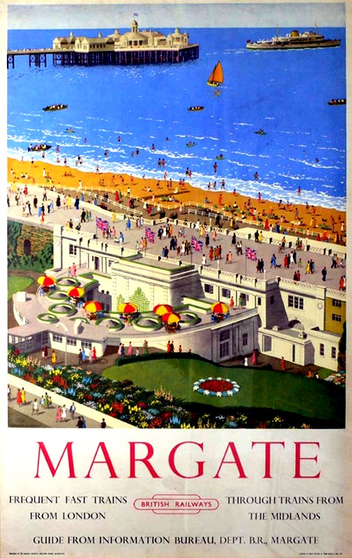
Margate is a seaside town in the district of Thanet in East Kent, England. It lies 38.1 miles (61.3 km) east-northeast of Maidstone, on the coast along the North Foreland, and contains the areas of Cliftonville, Garlinge, Palm Bay and Westbrook.

840_margate_03

History

Margate was recorded as "Meregate" in 1264 and as "Margate" in 1299, but the spelling continued to vary into modern times. The name is thought to refer to a pool gate or gap in a cliff where pools of water are found, often allowing swimmers to jump in. The cliffs of the Isle of Thanet are composed of chalk, a fossil-bearing rock.

840_margate_01The town’s history is tied closely to the sea and it has a proud maritime tradition. Margate was a "limb" of Dover in the ancient confederation of the Cinque ports. It was added to the confederation in the 15th century. Margate has been a leading seaside resort for at least 250 years. Like its neighbourRamsgate, it has been a traditional holiday destination forLondoners drawn to its sandy beaches. Margate had a Victorianpier which was largely destroyed by a storm in 1978.

Like Brighton and Southend, Margate was infamous for gang violence between mods and rockers in the 1960s, and mods and skinheads in the 1980s.

The Turner Contemporary art gallery occupies a prominent position next to the harbour. The Thanet Offshore Wind Project, completed in 2010, is visible from the seafront.

Tourism

840_margate_02For at least 250 years, Margate has been a leading seaside resort in the UK, drawing Londoners to its beaches, Margate Sands. The bathing machines in use at Margate were described in 1805 as

four-wheeled carriages, covered with canvas, and having at one end of them an umbrella of the same materials which is let down to the surface of the water, so that the bather descending from the machine by a few steps is concealed from the public view, whereby the most refined female is enabled to enjoy the advantages of the sea with the strictest delicacy.

Margate faces major structural redevelopments and large inward investment. Its Dreamland Amusement Park (featured in "The Jolly Boys’ Outing" extended episode of the television series Only Fools and Horses) was threatened with 840_margate_05closure because its site became worth more. In 2003, one of the arcades on the seafront was destroyed by fire; this has created a new potential entrance point to the Dreamland site. In 2004–2006 it was announced that Dreamland (although somewhat reduced in its amusements) would reopen for three months of the summer; a pressure group has been formed to keep it in being. The group is anxious to restore the UK’s oldest wooden roller coaster,

The Scenic Railway, which is Grade II* Listed and the second oldest in the world, was severely damaged in a fire on 7 April 2008. It was planned that the Dreamland site would reopen as a heritage amusement park in the near future 840_margate_06with the Scenic Railway at the centre. Classic rides from the defunct Southport amusement park have already been shipped in as well as parts of the now-demolished water chute at Rhyl. More details on Dreamland’s future are on the Dreamland Trust website. Today the Dreamland roller coaster is one of only two early-20th century scenic railways still remaining in the UK; the only other surviving UK scenic railway is in Great Yarmouth and was built in 1932. If the Dreamland Scenic Railway is not rescued, the Great Yarmouth coaster will become the last of its kind in the country. The Margate roller coaster is an ACE Coaster Classic.

Text from Wikipedia

Read Full Post »

marblethorp

Mablethorpe is a small seaside town in the East Lindsey district of Lincolnshire, England.

History

802_mablethorpe_01Mablethorpe as a town has existed for many centuries, although part of it was lost to the sea in the 1540s. For example, records of the Fitzwilliam family of Mablethorpe Hall date back to the 14th century. In the 19th century it was also a centre for ship breaking during the winter. Mablethorpe Hall is to the west of the town along Alford Road. It is near the parish church of St Mary (the Mablethorpe church group also includes Trusthorpe)

802_mablethorpe_02D. H. Lawrence; Mablethorpe is the destination for the Morel family’s first holiday in the D. H. Lawrence novel, Sons and Lovers, published in 1913. "At last they got an answer from Mablethorpe, a cottage such as they wished for thirty shillings a week. There was immense jubilation. Paul was wild with joy for his mother’s sake. She would have a real holiday now. He and she sat at evening picturing what it would be like. Annie came in, and Leonard, and Alice, and Kitty. There was wild rejoicing and anticipation. Paul told Miriam. She seemed to brood with joy over it. But the Morel’s house rang with excitement."


802_Sutton-on-Sea_01Sutton-on-Sea is a small coastal village in the East Lindsey district of Lincolnshire, England. It is situated at the junction of the A52 and A1111 roads, 6 miles (10 km) north-east from Alford and 2 miles (3.2 km) south fromMablethorpe. The village is part of the civil parish of Mablethorpe and Sutton.

Village facilities include a post office, public houses, a general store and a hotel, and a paddling pool on the sea front.

History

At very low tides it is possible to view the remains of an ancient submerged forest on the beaches of Mablethorpe and Sutton on Sea.

802_Sutton-on-Sea_02The church, which is a Grade II listed building, is dedicated to Saint Clement. It was built in 1818-19 on a new site after the previous church was destroyed by the sea.

The Alford and Sutton Tramway ran from Alford town to Sutton-on-Sea on rails set into the road. It opened in 1884 and closed 5 years later.

Sutton-on-Sea railway station opened as part of the Sutton and Willoughby Railway. It closed on 5 October 1970 by which time it was owned by British Rail.

In 1897 the village was the subject of a plan by the Lancashire, Derbyshire and East Coast Railway to build a port and harbour at the terminus of its East-West line to Warrington on the Manchester Ship Canal. However, by the time the line reached Lincoln the money had run out and Lincoln remained its terminus.

Text from Wikipedia

Read Full Post »

ÔLoch LomondÕ, BR poster, 1959.

Loch Lomond (/ˈlɒxˈlmənd/; Scottish Gaelic Loch Laomainn) is a freshwater Scottish loch which crosses the Highland Boundary Fault. It is the largest inland stretch of water in Great Britain by surface area. The loch contains many islands, including Inchmurrin, the largest fresh-water island in the British Isles. Loch Lomond is a popular leisure destination and is featured in song.

788_loch lomond_01

Geography

Loch Lomond is a freshwater loch lying on the Highland Boundary Fault, often considered the boundary between the lowlands of Central Scotland and the Highlands. It is 39 kilometres (24 mi) long and between 1.21 kilometres (0.75 mi) and 8 kilometres (5.0 mi) wide. It has an average depth of about 37 metres (121 ft), and a maximum depth of about 190 metres (620 ft). Its surface area is 71 km2 (27 sq mi), and it has a volume of 2.6 km3 (0.62 cu mi). Of all lochs and lakes in Great Britain, it is the largest by surface area, and the second largest (after Loch Ness) by water volume. Within the United Kingdom, it is surpassed only by Lough Neagh and Lower Lough Erne in Northern Ireland and regarding theBritish Isles as a whole there are also several larger loughs in the Republic of Ireland.

788_loch lomond_03

Traditionally a boundary between Stirlingshire and Dunbartonshire, Loch Lomond is currently split between the council areas of Stirling, Argyll and Bute, and West Dunbartonshire. Its southern shores are about 23 kilometres (14 mi) north of Glasgow, Scotland’s largest city.

Loch Lomond is now part of Loch Lomond and the Trossachs National Park. Ben Lomond is on the eastern shore: 974 m (3,195 ft) in height and the most southerly of the Scottish Munro peaks. A 2005 poll of Radio Times readers voted Loch Lomond as the 6th greatest natural wonder in Britain.

788_loch lomond_04

The main arterial route along the loch is the A82 road which runs the length of its western shore. For a long time this was a notorious bottleneck, with the route clogged with tourists during the summer months. It was upgraded in the 1980s and 1990s, although the stretch north of Tarbet remains unimproved.

Text from Wikipedia 

Read Full Post »

llandudno

Llandudno (/θlænˈdɪdn/ or /lænˈdɪdn/; Welsh pronunciation: [ɬanˈdɪdnɔ]) is a seaside resort, town and communityin Conwy County Borough, Wales, located on the Creuddyn peninsula. In the 2011 UK census, the community, which includes Penrhyn Bay and Penrhynside, had a population of 20,710.

774_llandudn_02

Llandudno, "Queen of the Welsh Resorts", a title first applied as early as 1864, is now the largest seaside resort in Wales, and lies on a flat isthmus of sand between the Welsh mainland and the Great Orme. Historically a part of Caernarfonshire, Llandudno was formerly in the district of Aberconwy within Gwynedd.

History

774_llandudn_03The town of Llandudno developed from Stone Age, Bronze Age and Iron Age settlements over many hundreds of years on the slopes of the limestone headland, known to seafarers as the Great Orme and to landsmen as the Creuddyn Peninsula. The origins in recorded history are with the Manor of Gogarth conveyed by King Edward I to Annan, Bishop of Bangor in 1284. The manor comprised three townships, Y Gogarth in the south-west, Y Cyngreawdr in the north (with the parish church of St Tudno) and Yn Wyddfid in the south-east.

Great Orme

774_llandudn_04Mostly owned by Mostyn Estates. Home to several large herds of wild Kashmiri goats originally descended from several goats given by Queen Victoria to Lord Mostyn. The summit of the Great Orme stands at 679 feet (209 M). The Summit Hotel which is now a tourist attraction was once the home of world middleweight champion boxer Randolph Turpin.

A haven for flora and fauna with some rare species such as peregrine falcons and a species of wild cotoneaster (cambricus)which can only be found on the Great Orme. The sheer limestone cliffs of the Great Orme provide ideal nesting conditions for a wide variety of sea birds, including cormorants, shags, guillemots, razorbills, puffins, kittiwakes, fulmers and numerous other gulls.

This great limestone headland has many attractions including the Great Orme Tramway and a cable car system that takes tourists effortlessly to the summit.

774_llandudn_01

Transport

The town is just off the North Wales Coast railway line which was opened as the Chester and Holyhead Railway in 1848, became part of the London and North Western Railway in 1859, and part of the London, Midland and Scottish Railway in 1923. Llandudno was specifically built as a mid-Victorian era holiday destination and is served by a branch railway line opened in 1858 from Llandudno Junction with stations at Deganwy and Llandudno.

Read Full Post »

lancashire

Stretching from the Lune Estuary at Glasson Dock to the Kent Estuary at Arnside, the spectacular coastline of Lancashire provides surprising contrasts. 743_lanca01From stunning sunsets, dramatic landscapes and glorious views, to seaside towns, fish and chips and harbours steeped in maritime history, Lancashire quite simply has it all!

Genteel Lytham St Annes, maintains the elegance of Victorian England, with the glorious garden lined seafront, home to the charming Victorian Pier, Bandstand and Promenade and many historic sites 743_lanca03such as Lytham Hall and the famous Lytham Green Windmill.

Travel along the stunning coast northwards beyond Blackpool and Cleveleys and you will arrive at Fleetwood, a bustling harbour town with a rich marine heritage, best explored at the comprehensive Fleetwood Museum. Shop for bargains at the popular Fleetwood Freeport Village situated in the tranquil marina. Take a stroll 743_lanca02alongMorecambe’s superb five mile long promenade and enjoy the unique and stunning views across Morecambe Bayto the hills of the Lake District. Relax and unwind, simply breathe in the fresh coastal air and enjoy a unique experience breathing in the fresh coastal air or experience the thrill of sailing in this unique natural playground.

Text from VisitLancashire.com

Read Full Post »

knaresborough

Knaresborough /nɛərzb(ə)rə/ is an historic market town, spa town and civil parish in the Borough of Harrogate, North Yorkshire, England. Historically part of the West Riding of Yorkshire, it is located on the River Nidd, 4 miles (6.4 km) east from the centre of Harrogate.

History

730_knaresborough_03Knaresborough is mentioned in the Domesday Book as Chenaresburg, meaning ‘Cenheard’s fortress’. Knaresborough Castle dates from Norman times; around 1100, the town began to grow and provide a market and attract traders to service the castle. The present parish church, St John’s, was established around this time. The earliest name for a Lord of Knaresborough is from around 1115 when Serlo de Burgh held the ‘Honour of Knaresborough’ from the King.

Hugh de Morville was granted the Honour of Knaresborough in 1158. He was constable of Knaresborough and leader of the group of four knights who murdered Archbishop Thomas Becket at Canterbury Cathedral on 29 December 730_knaresborough_021170. The four knights fled to Knaresborough and hid at the castle. Hugh de Morville forfeited the lands in 1173, not for his implication in the murder of Thomas Becket, but for "complicity in the rebellion of young Henry", according to the Early Yorkshire Charters.

The Honour of Knaresborough then passed to the Stuteville family. When the Stuteville line was broken with the death of Robert de Stuteville the 4th in 1205, King John effectively took the Honour of Knaresborough for himself. The first Maundy Money was distributed in Knaresborough by King John on 15 April 730_knaresborough_011210. Knaresborough Forest, which extended far to the south of the town, is reputed to have been one of King John’s favourite hunting grounds.

Although a market was first mentioned in 1206, the town was not granted a Royal Charter to hold a market until 1310, by Edward II. A market is still held every Wednesday in the market square. During Edward II’s reign, the castle was occupied by rebels and the curtain walls were breached by a siege engine. Later, Scots invaders burned much of the town and the parish church. In 1328, as part of the marriage settlement, Queen Philippa was granted "the Castle, Town, Forest and Honour of Knaresborough" by Edward III and the parish church was restored. After her death in 1369, the Honour was granted by Edward to their younger son, John of Gaunt, the Duke of Lancaster 730_knaresborough_05and since then the castle has belonged to the Duchy of Lancaster. After the accession of Henry IV the castle lost much of its importance in national affairs, but remained a key site in regional administration for another century.

During the Civil War, following the Battle of Marston Moor in 1644, the castle was besieged by Parliamentary forces. The castle eventually fell and in 1646 an order was made by Parliament for its destruction (but not carried out till 1648). The destruction was mainly done by citizens looting the stone. Many town centre buildings are built of ‘castle stone’.

Text from Wikipedia 

Enhanced by Zemanta

Read Full Post »

Older Posts »